![]() Voluntary citizens' group
Voluntary citizens' group
"I mati dela Sorna" of Brentonico
No address or telephone number
Please refer to the author
(logo by Aldo Ripamonti)
![]() Voluntary citizens' group
Voluntary citizens' group
"I mati dela Sorna" of Brentonico
No address or telephone number
Please refer to the author
(logo by Aldo Ripamonti)
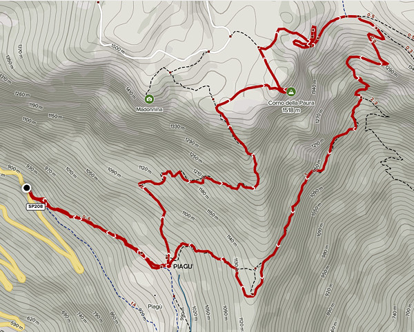
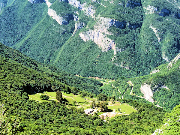
The unknown Piagu' plateau is located in Val dei Molini just above the village of Avio
Piagu' is a small plateau above Avio Castle. The area is managed exclusively by the humanitarian association "Mato Grosso' and here few people and many animals live together. A small Eden in the Pre-Alps of Trentino at the foot of Monte Baldo. We found a ring itinerary that puts together the Piagu' and the Corno della Paura, a peak famous in the vicissitudes of the First World War. The paths that make up the ring-route are of different origins. The path that descends from the Corno della paura to Bocca d'Ardole is a road military road from the First World War (1915-1918). The path that descends to Avio Castle is of ancient origin, the others were traced by the Mato Grosso Association and are mostly unknown and sometimes not marked on maps.
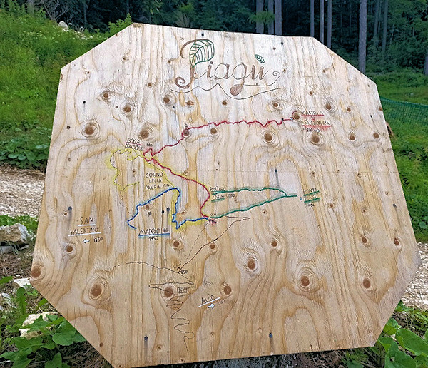
The notice board painted by the volunteers of the 'Mato grosso' association at the beginning of our itinerary
From the town of Avio, drive up the Valle dei Mulini, after a few kilometres you will see clear signs on the right and park in the small spaces on the left. Follow the dirt road for about 100 m, and a path starts to the left which soon leads to Piagù. You walk past the houses until you come to an explanatory sign, take the Sentiero della Madonna to the left. The path is poorly signposted and leads, after about an hour, under the rocks of the Corno della Paura. Recently (2022), a new path was traced out by the SAT di Brentonico path that, passing under the walls of the Corno della paura, leads directly to Bocca d'Ardole, avoiding the ascent to the summit of the Corno (?!). We instead, at the junction with the aforementioned path, continue straight ahead on the path of the Madonna, which here is discreetly marked with red bolts. It climbs for about 50 metres on a very steep edge, among grass and stones, which requires experience on mountain paths: it is the only difficulty of the climb. Continue, following the arrows, to a fork. The path continues down into a small valley, but it is possible, keeping to the right climb directly to the summit of the Corno della Paura, visible from below.
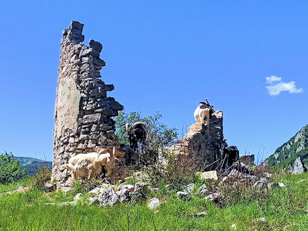
The remains of an ancient watchtower that no one has been able to tell us anything about
After visiting the First World War emplacements, we descend on the historic road that shortly leads to Bocca d'Ardole. A path cuts the steep slope to the right, the ground is sometimes uneven and leads to a crossroads with signs where you turn right towards direction Piagù. We follow a path halfway up the slope for a long time until we come to a knoll where there are the ruins of an ancient watchtower. In a wide enclosure, in the shadow of the tower are about ten friendly little goats. Having circumvented the enclosure, descend into a small valley to Piagu' and along a comfortable path back to the car.
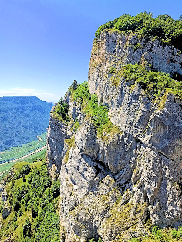
The imposing Corno della Paura tower on Monte Baldo Trentino
WARNING - The group of volunteer citizens called 'I mati dela Sorna' has worked hard to make the trek as safe as possible. Keep in mind that Monte Baldo is still a mountain and, as with all excursions in an alpine environment, it is not absolute safety cannot be guaranteed.
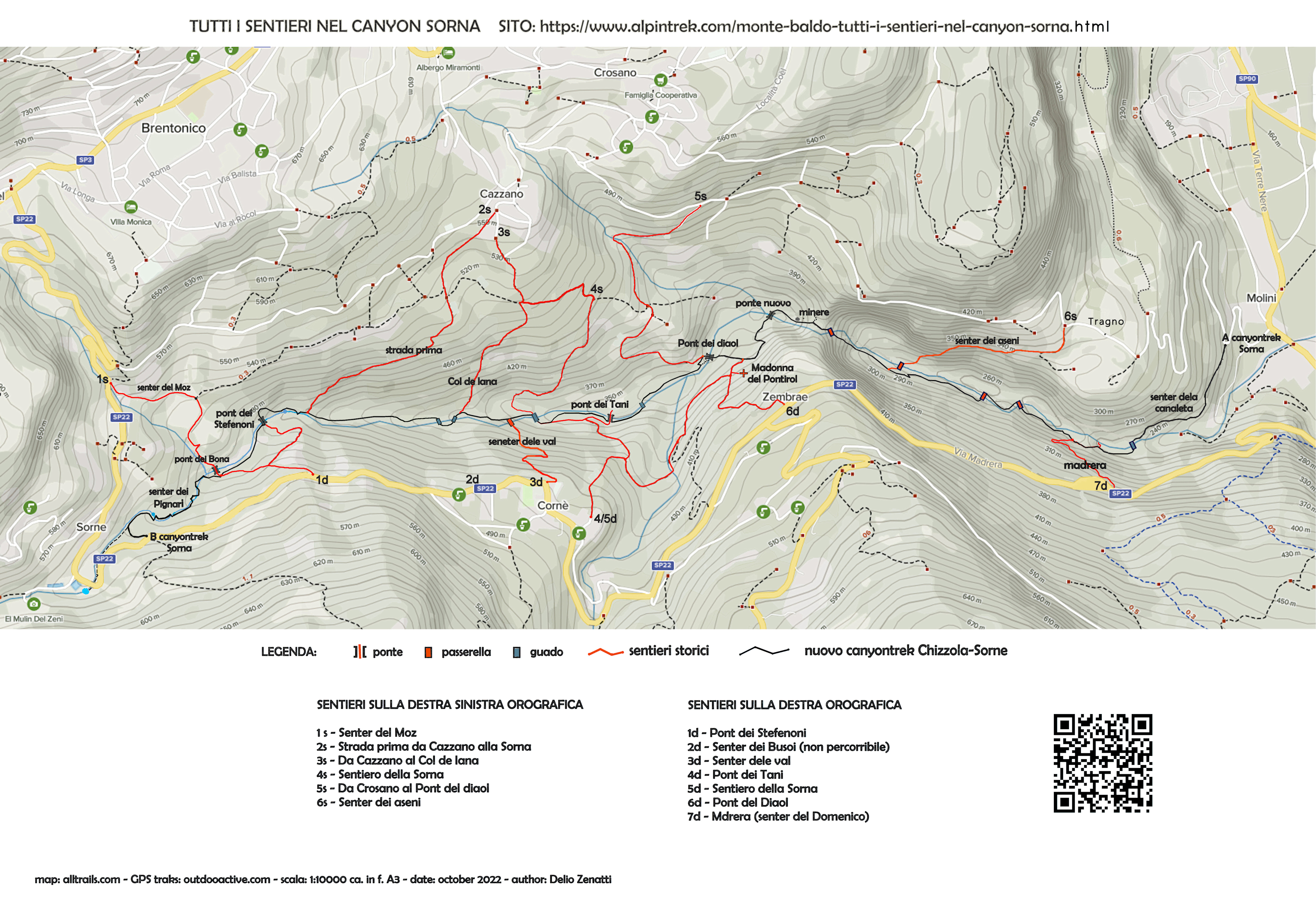
MONTE BALDO TUTTI I SENTIERI NEL CANYON SORNA - MAP CANYONTREK SORNA
UNKNOWN PATS ON MONTE BALDO - SENTIERI SCONOSCIUTI SUL MONTE BALDO
CORNALE' - BANCHETA - PIGNARI - BRACON - ASENI - SAIORI - PIAGU' - PIAZZINA - ALBI - CROSANO - POLSA - LODRON
SOURCES - From outdooractive.com, you can also download the gpx file of the route.
Web site https://out.ac/IAO7gi
Alltrails.com maps - Delio Zenatti's gps tracks on outdooractive.com