![]() Voluntary citizens' group
Voluntary citizens' group
"I mati dela Sorna" of Brentonico
No address or telephone number
Please refer to the author
(logo by Aldo Ripamonti)
![]() Voluntary citizens' group
Voluntary citizens' group
"I mati dela Sorna" of Brentonico
No address or telephone number
Please refer to the author
(logo by Aldo Ripamonti)
The route is designed in such a way that the sometimes steep paths go uphill while, to return to Saccone, one walks
on relatively comfortable dirt and asphalt roads.
You park at the Saccone cemetery, the only place with enough space in the village. Go up through the village and straight on to a signpost
indicating 'via Giannetti' on the right. Follow the road slightly uphill and at a crossroads, turn left passing under an ancient arch.
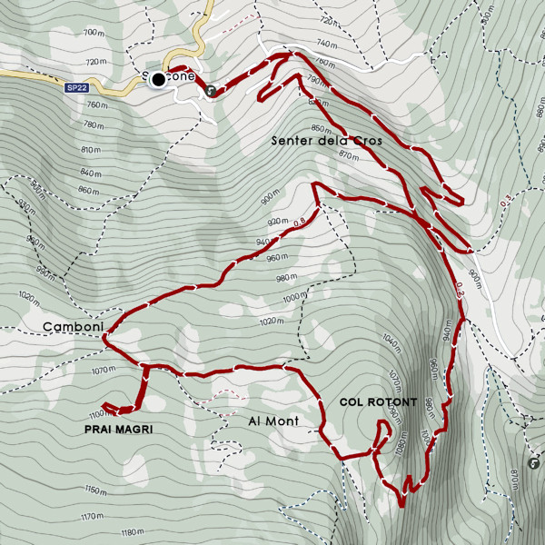
Continue, following the road southwards, until you see an ancient cross carved into a single block of rock. Here you turn left onto a
path, called "Senter dela cros" in dialect, and continue up a sometimes steep slope until you reach the road that descends from the locality
"Al Mont".
The cross above the village of Saccone whose provenance is unknown
Walk along the road, towards the valley for about 50 metres, until you come to a sign indicating "Madonna della Crona - Observatory", installed for the reason that this is the descent path for another route. One ascends to the right on a dirt road until reaching briefly to a crossroads where two houses can be seen, a sign on a plant again indicates "Madonna - Observatory". One ascends to the right on the famous "Sentiero della pace' (Peace Path) on sometimes steep and gravelly terrain until you reach a meadowy plateau. One crosses the meadows where there are a couple of huts until you glimpse to the right a small hill known in dialect as "Col rotont" (Round Hill).
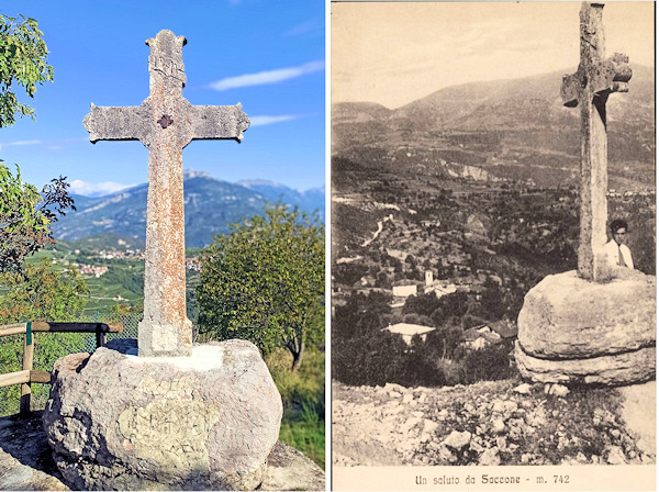
The war tunnel where the command post was probably located
The path climbs to the top of the hill where there are some fortifications from the First World War:towards
the Adige Valley you can see the dome of a concrete blockhouse on which a machine gun was installed. Some attention is required when visiting
the numerous trenches and tunnels as they can be subject to landslides. Back in the valley, follow the path slightly uphill for about 100 metres,
passing two house ruins, until you reach a crossroads with signs. You turn decisively to right and at the beginning on a steep but short dirt
road, after a long traverse, northwards practically level, you reach the locality 'Al Mont' where the old houses have been converted into summer
residences for the inhabitants of the village. Just before reaching the locality 'Camboni' (marked on the maps), an isolated house can be seen
on the right below the road; on the left, a small road climbs up that leads to a large grassy area where there are two cottages. One climbs
slightly further north at a barrier and soon reaches the Prai magri where you can see, now almost buried in the vegetation, the old Saccone
dwelling. You are in the presence of the famous 'stol' described by Luigi Zenatti as one of the first 'houses' of Saccone, almost impossible
to reach without the GPS point 45.784346, 10.970119.
From the Camboni locality, descend until reaching the asphalted or cemented road that leads back to Val dei Berti, passing downhill the crossroads
encountered on the ascent. Here you can descend along the "Senter dela Cros" or, more comfortably, along the little road that runs through the
Val dei Berti until returning to the village of Saccone.
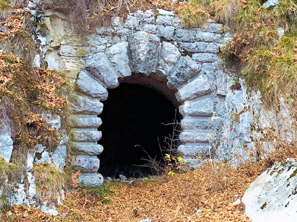
On Col rotont there is a network of trenches and a tunnel, caution is advised
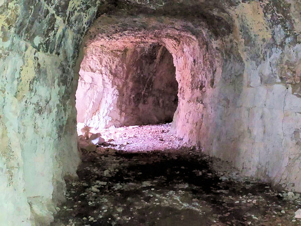
A photo from 1997 depicting Luigi Zenatti in front of a strange cave, taken at 'Al Mont' in Saccone, attracted our curiosity. We immediately began the search to find the exact location, which was soon discovered, as one of our group members is the owner of the forest in which the cave is located. The place is located in a typical sylvan-pastoral environment of the Trentino and served by a dense network of paths and forest roads. The next step was the identification of an easy route that allow all normal hikers to visit the place; cleaning the area required a subsequent effort.
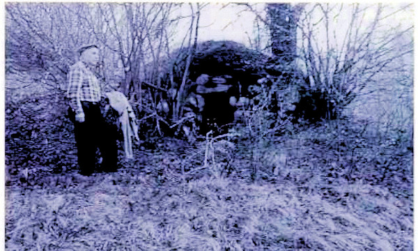
Photo from 1997 showing Luigi Zenatti at the entrance of an old house
(From an article by Luigi Zenatti)
Saccone's legend does not mention dwellings, while Prada's legend informs us that shepherds lived in caves. I am not aware that on the slopes
of the Vignola there are many caves if we exclude the shelters dug during the First World War. Nor is it conceivable that the current houses
of the Pozza, Bortolasi, Monte or Bracon farms were their dwellings. These are of recent date, in the late 1800s, after the elevation and
roofing with tiles of the village houses. Some were built between the two world wars. The first dwelling is hard to imagine, but I guessed
it by looking at some of the country houses. The house then consisted of only one room completely underground with the exception of the
entrance room, which also served as a window to let in air and light. I saw one recently; it is located in the locality we call 'Prai Magri',
not far from the Val del Pozzo. The area is indicated as Pian dei Barchi on the topographical map and this improperly because it consists of
grassy but steep valleys that descend from the malga Cestarelli. During haymaking, some meadow owners still used that hut to store tools and
provisions. Next to the entrance is the hearth: three rounded porphyry stones to fit the cauldron or frying pans. No one, not even the oldest knew
tell me who had built that underground chamber, and they confirmed that even their grandparents didn't know; it had always been there. One old
man, however told me a very strange story, saying that he too had heard it and that the underground dwelling had always attracted my attention.
Whoever built it made an excavation about three metres long, keeping a level above the bottom of the valley, and on its side to allow rainwater
to flow. He lined the excavation with large stones, curving the walls inwards after the height of a man. To do this he had to put a counterweight
towards the outside and he did this with earth from the excavation. He finished the ceiling with slabs and covered everything with earth on which
grass grows. It looks like a natural hump; I am convinced that if you removed the earth, the whole thing would collapse. This may have been the
case with the other constructions, starting the removal on the wall side; here, however, it started on the side of the opening.
I think it was dug out on the opposite side of the valley and was used to shelter the flock during the winter, by superimposing logs carrying
branches. For watering, there was a puddle (called a gorga) in a small plain at the bottom of the valley, where rainwater flowed in.
That place is now called Pian dei Vighi and two villas were built there by Milanese families.
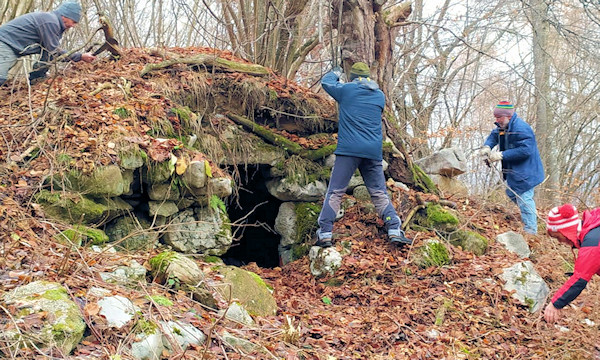
Our stol cleaning work
NOTE BY THE AUTHOR
As suggestive as the article is, there is no archaeological evidence that the inhabitants of Saccone resided
in the locality all year round. They were probably residents of Prada who lived here in the summer during haymaking.
WARNING - The group of volunteer citizens called 'I mati dela Sorna' has worked hard to make the trek as safe as possible. Keep in mind that Monte Baldo is still a mountain and, as with all excursions in an alpine environment, it is not absolute safety cannot be guaranteed.
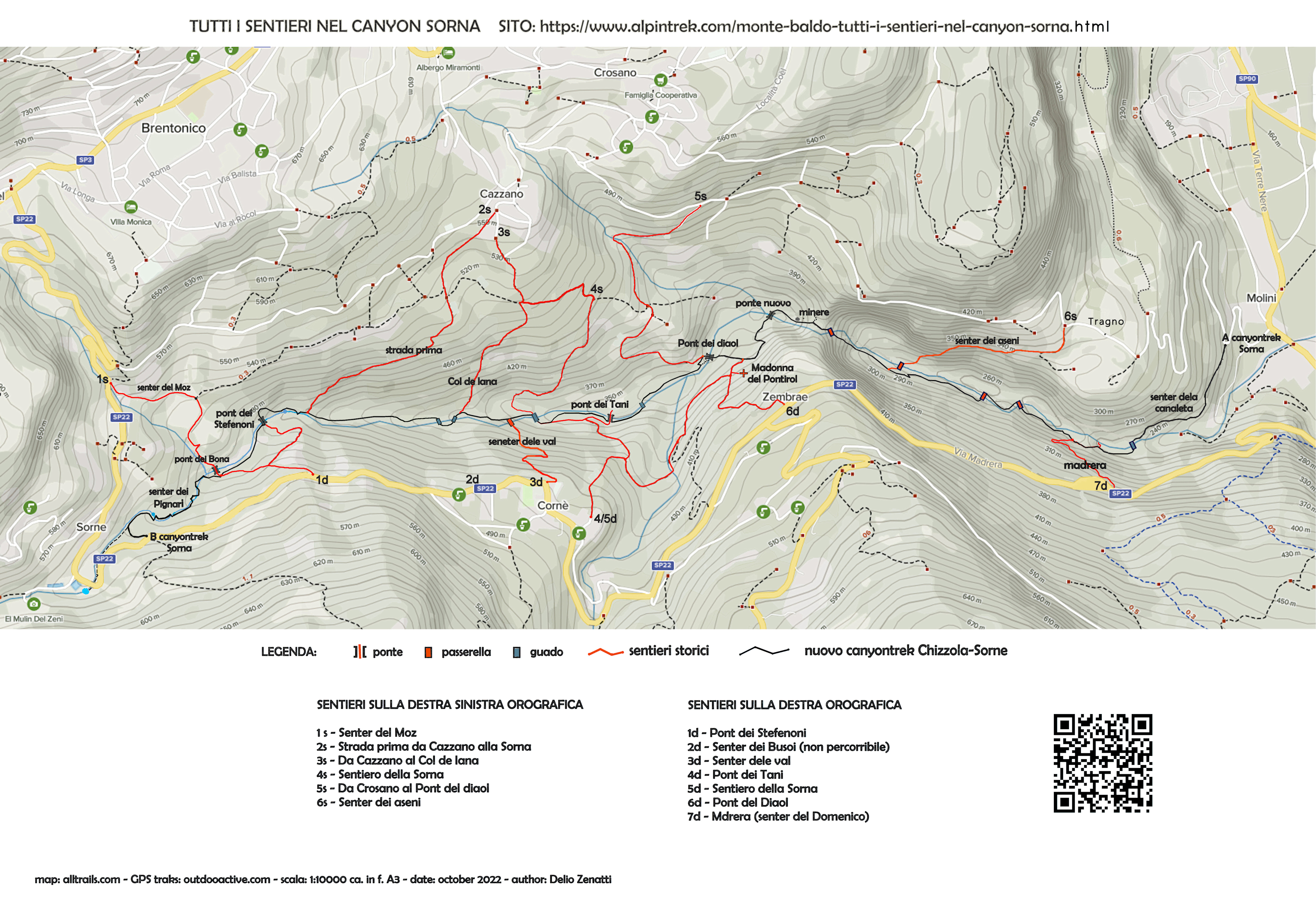
MONTE BALDO TUTTI I SENTIERI NEL CANYON SORNA - MAP CANYONTREK SORNA
UNKNOWN PATS ON MONTE BALDO - SENTIERI SCONOSCIUTI SUL MONTE BALDO
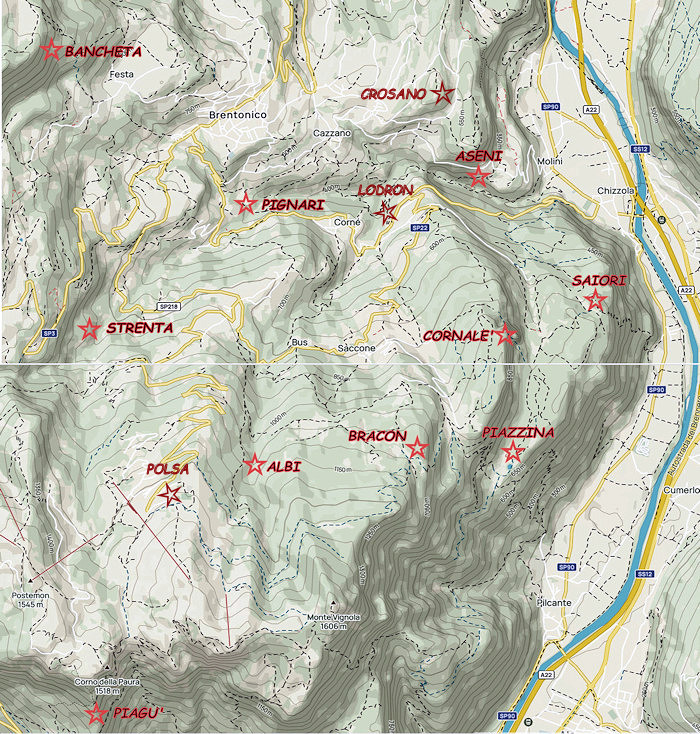
CORNALE' - BANCHETA - PIGNARI - BRACON - ASENI - SAIORI - PIAGU' - PIAZZINA - ALBI - CROSANO - POLSA - LODRON
SOURCES - From outdooractive.com, you can also download the gpx file of the route.
Web site https://out.ac/IKKqrc
Alltrails.com maps - Delio Zenatti's gps tracks on outdooractive.com